UN
16 Poplar Avenue
£ 492,000
Description
We don't have a Description for this property.
- Bedrooms
- 4
- Bathrooms
- 0

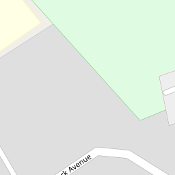

Leaflet © OpenStreetMap contributors
The heatmap indicates the level of crime in the area. The color of the heatmap indicates the crime severity and recency.
Metrics Year-on-Year
- Average area value
- 376,936.00 £Increased by 1.71 %
- Average area rental value
- 1,412.00 £/moIncreased by 13.87 %
- Est rental Yield
- 4.50 %Increased by 11.94 %
- Crime Rate
- 2.00 %Unchanged by 0.00 %
from 370,600.00 £
from 1,240.00 £/mo
from 4.02 %
from 2.00 %
Nearby Schools
| Name | Type | Ofsted | Distance |
|---|---|---|---|
| Crosby High School | Community Special School | Good | 0.38 KM |
| Great Crosby Catholic Primary School | Voluntary Aided School | Good | 0.70 KM |
| Forefield Junior School | Community School | Good | 0.86 KM |
| Sacred Heart Catholic College | Voluntary Aided School | Requires improvement | 1.00 KM |
| Forefield Community Infant And Nursery School | Community School | Outstanding | 1.04 KM |
Images
Nearby Streets
| Name | Average Price | Average Sqft | Distance |
|---|---|---|---|
| Highfield Grove | £ 0 | 0 | 0.00 KM |
| Mayfair Avenue | £ 0 | 0 | 0.00 KM |
| Moor Lane | £ 0 | 0 | 0.00 KM |
| Wylva Avenue | £ 270,000 | 0 | 0.00 KM |
| White Meadow Drive | £ 180,000 | 0 | 0.00 KM |
Nearby Transport
| Name | NLC | TLC | Distance |
|---|---|---|---|
| Waterloo (Merseyside) | 2133 | WLO | 2.50 KM |
| Blundellsands And Crosby | 2123 | BLN | 2.73 KM |
| Seaforth And Litherland | 2250 | SFL | 3.48 KM |
| Hall Road | 2229 | HLR | 3.67 KM |
| Bootle New Strand | 2195 | BNW | 5.28 KM |
Nearby Listings
| Address | Price | Type | Score | Distance |
|---|---|---|---|---|
| Moor Lane, Liverpool, L23 2 | £ 549,999 | BUY | Unknown | 0.14 KM |
| Moor Lane | Crosby | £ 425,000 | BUY | 8 / 10 | 0.20 KM |
| Moor Lane, Crosby, Liverpool | £ 650,000 | BUY | 6 / 10 | 0.21 KM |
| Brentwood Avenue, Crosby, Liverpool | £ 450,000 | BUY | 6 / 10 | 0.26 KM |
| Windmill Avenue, Liverpool, Merseyside, L23 | £ 320,000 | BUY | Unknown | 0.31 KM |
Nearby Properties
| Address | Price | Distance |
|---|---|---|
| 2a Poplar Avenue | £ 170,000 | 0.00 KM |
| 16 Poplar Avenue | £ 492,000 | 0.00 KM |
| 22 Poplar Avenue | £ 220,100 | 0.00 KM |
| 6 Poplar Avenue | £ 392,000 | 0.00 KM |
| 24 Poplar Avenue | £ 700,000 | 0.00 KM |